FICHE DESCRIPTIVE - RESEAU GPS Corinthe | ||
ordre 1
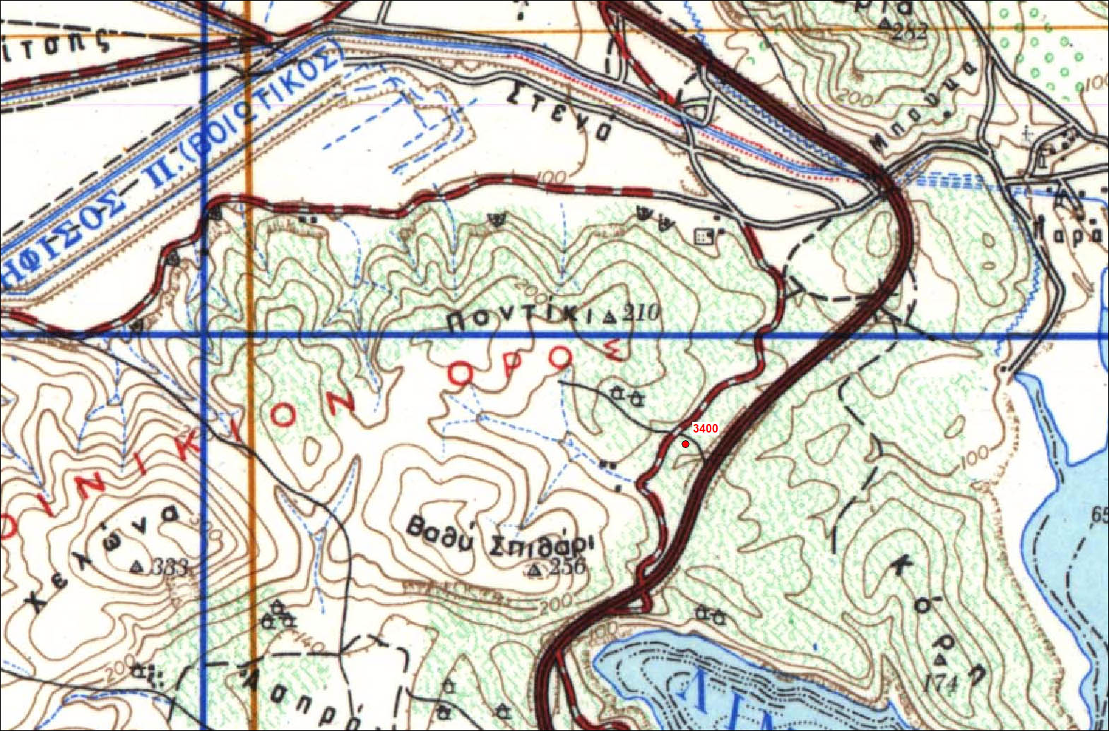
| 3400 | Limni Yliki | CG34 |
| WGS84 | ||
| 38° 25' 35'' N | 23° 13' 20'' E | 170 m |
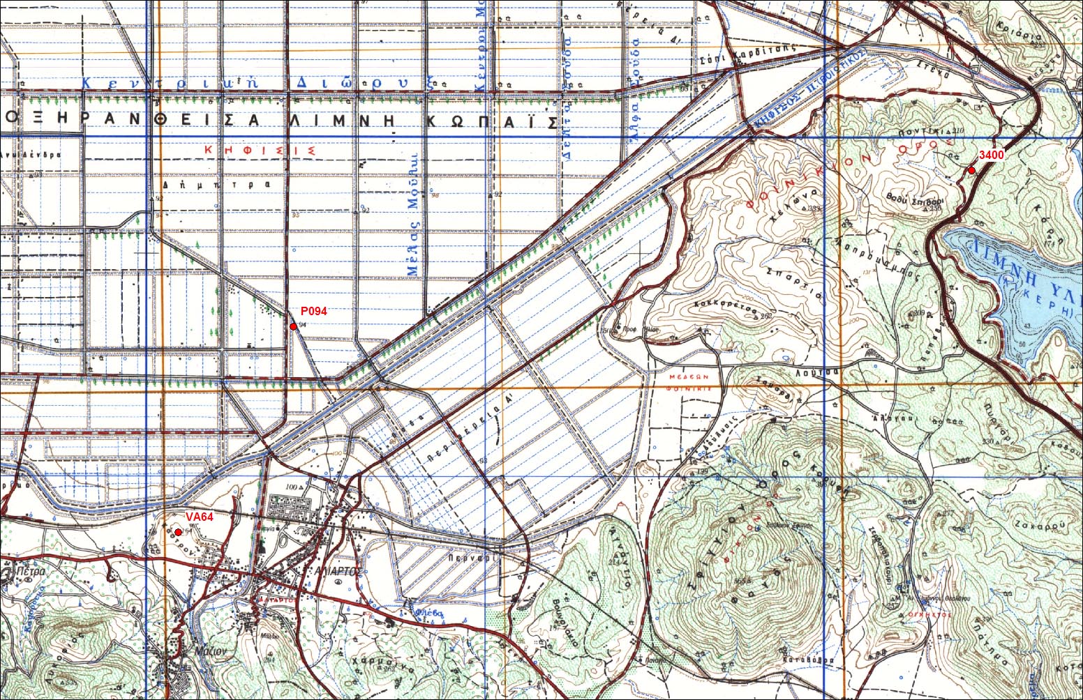
Carte: Vayia 1/50.000
| Point | Azimut et distance | Type de repère | Observations | |
|---|---|---|---|---|
| CG34 | N | m | Repère | |
| 061-108 | N | m | Pilier | P133 - Kastro |
| 64VA | N | m | Pilier | 64VA - Aliartos |
| CG34-1 | N 75 | 6.14 m | Repère | Auxiliaire 1 |
| CG34-2 | N 180 | 5.65 m | Repère | Auxiliaire 2 |
| CG34-3 | N | m | Repère | Auxiliaire 3 |
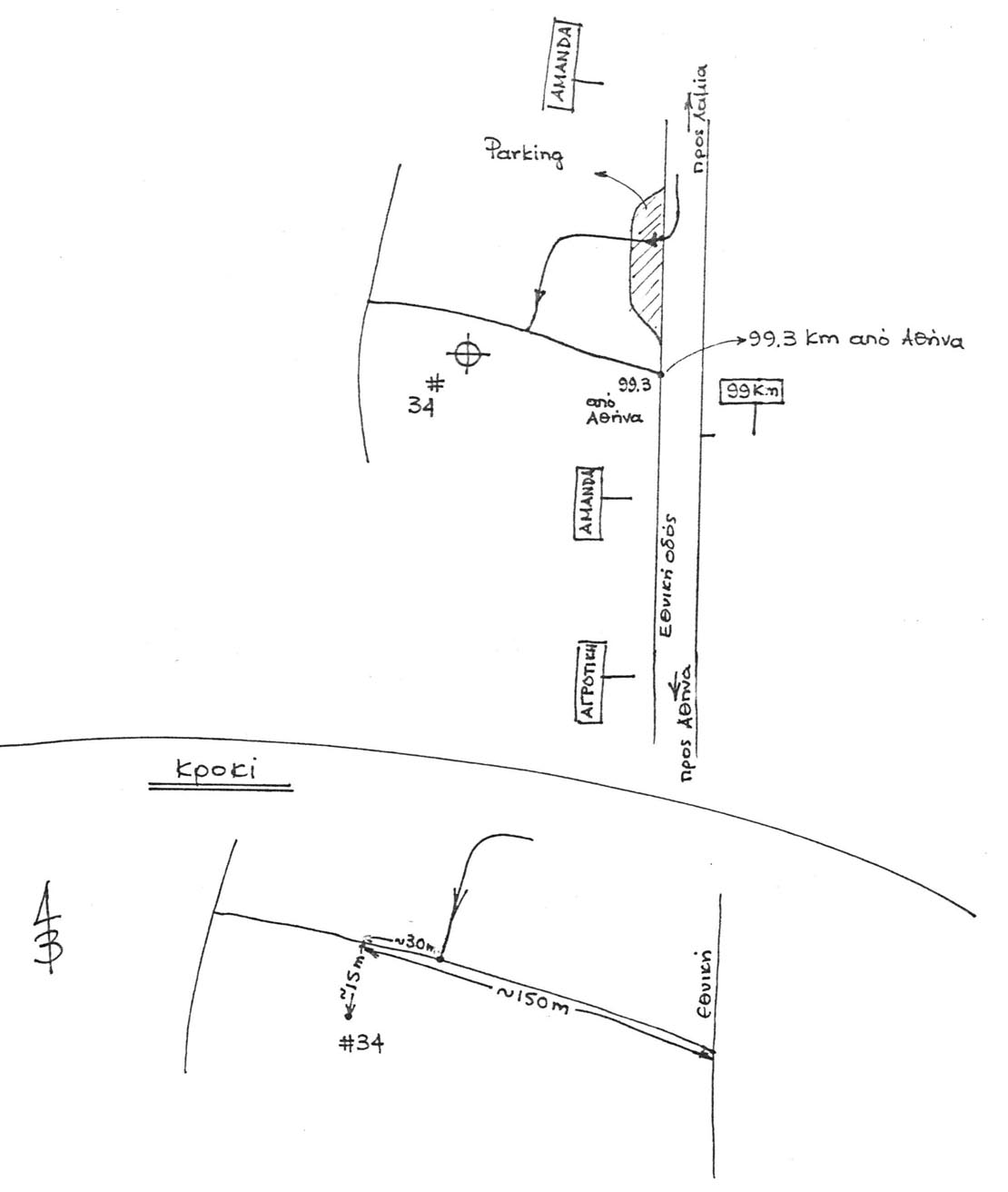
Accès:
Enter in the highway Athens-Lamia at Akrefnio entrance in the direction of Athens and proceed for 2.5 km until a parking on the right. At the end of the parking there is a green kilometric panel with marked ‘99km’. Continue for 100m and then turn on the right on a small ground road (not asphalted). Proceed along with this ground road for ~100m until a little intersection with another ground road going down toward the highway. Park the car just after this intersection. The point is located approximately 15m up on the south (left coming from the highway) of the road.
 |
 |
 |
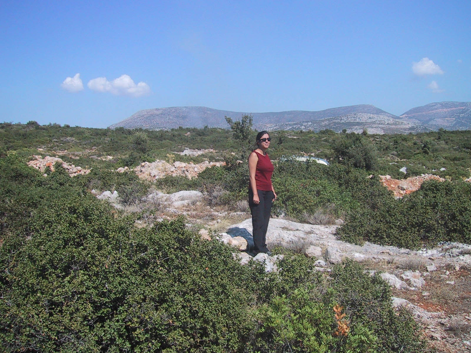 |
| 2 Octobre 2004 - Vue N0E |
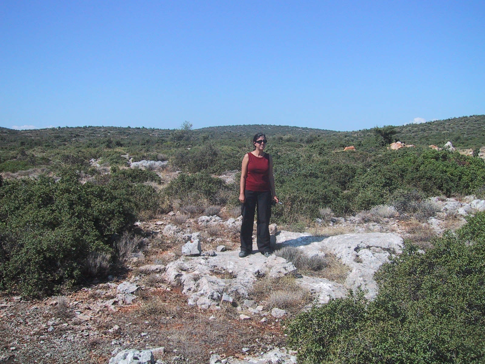 |
| 2 Octobre 2004 - Vue 90E |
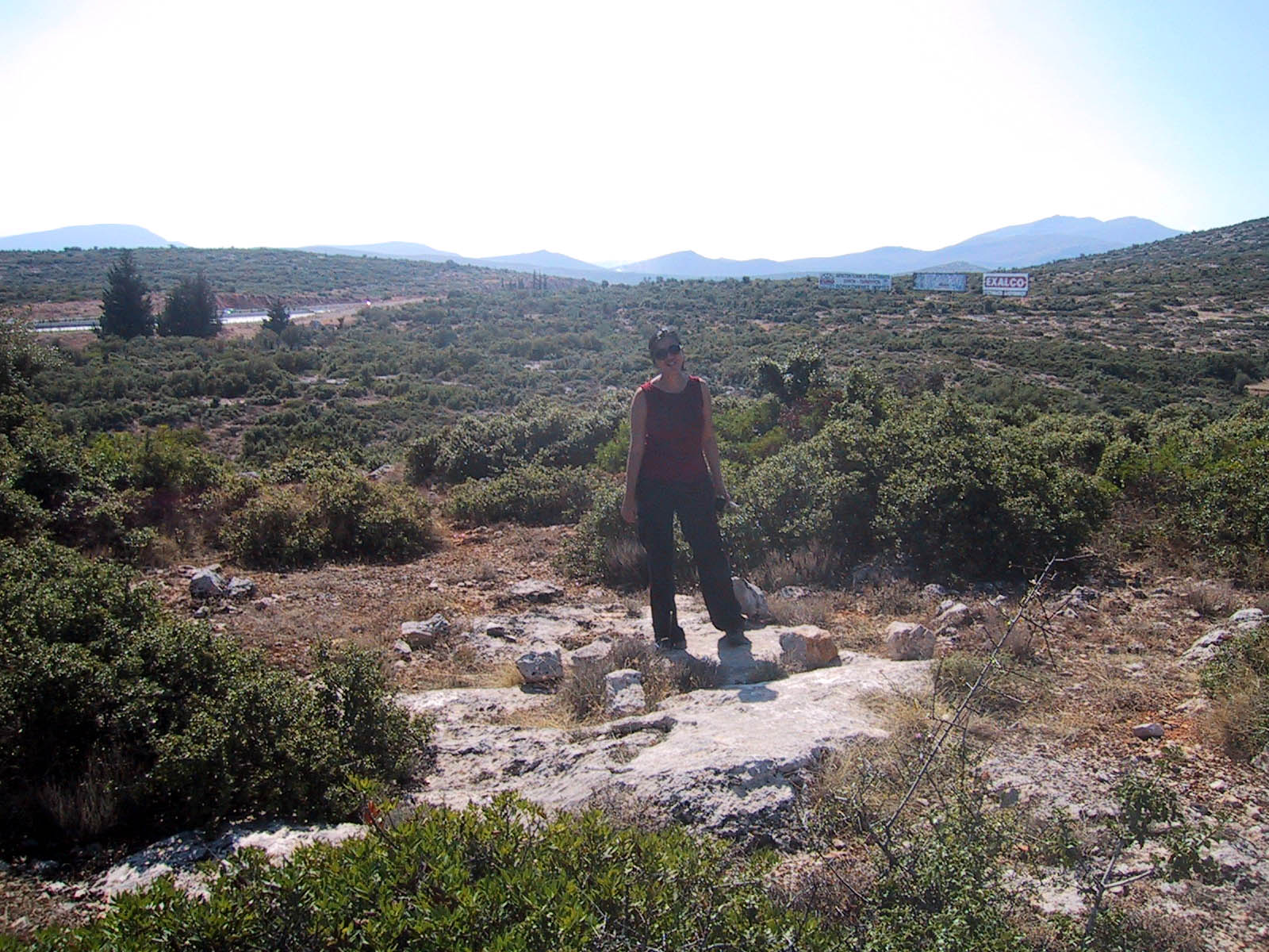 |
| 2 Octobre 2004 - Vue 180E |
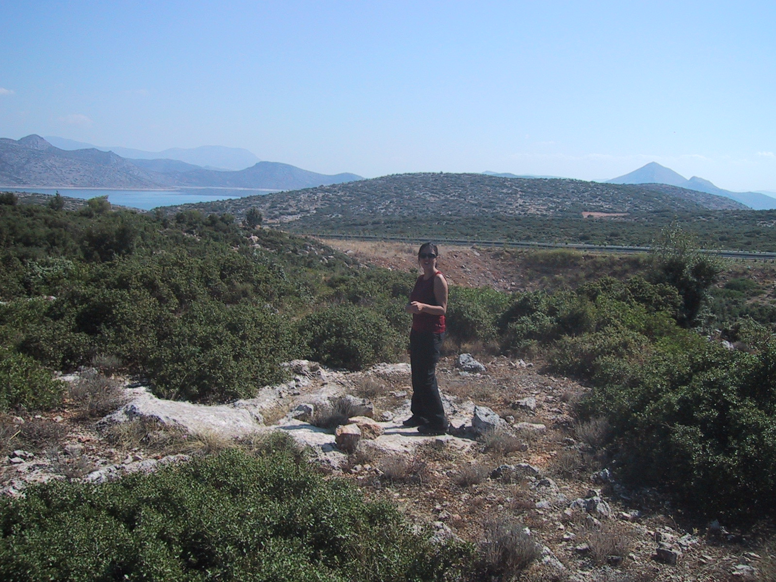 |
| 2 Octobre 2004 - Vue 270E |
Contacts:
Historique:
Mesures 1997:
1997/10/02 15:50-23:59 1.221 OXF5
1997/10/03 00:00-05:11 1.221 OXF5
1997/10/05 16:06-23:59 0.996 OXF5
1997/10/06 00:00-05:14 0.996 OXF5
1997/10/06 15:58-23:59 0.962 OXF5
1997/10/07 00:00-05:15 0.962 OXF5
1997/10/07 16:38-23:59 0.816 OXF5
1997/10/08 00:00-04:15 0.816 OXF5
1997/10/08 05:02-09:02 1.124 NTU2 Trimble Equipe NTUA
1997/10/09 04:59-09:00 0.828 NTU2
Fichiers RINEX disponibles: