FICHE DESCRIPTIVE - RESEAU GPS Corinthe | ||
|
|
|
ordre 1
| WGS84 |
| 38° 08' 34'' N | 22° 22' 49'' E | 9 m |
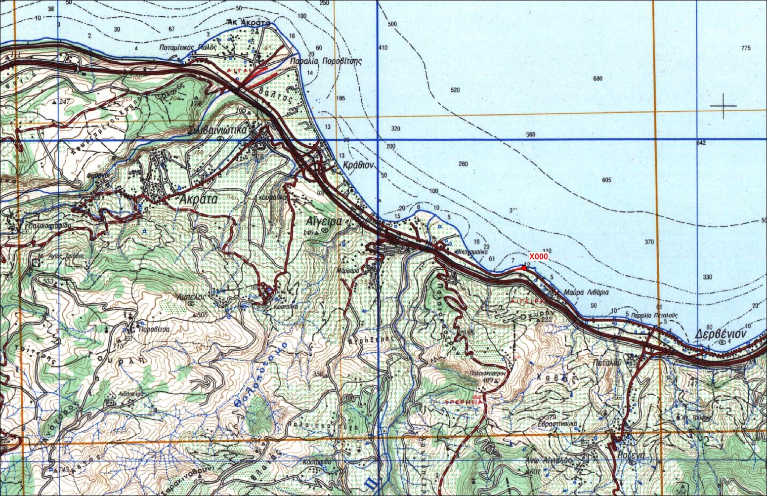
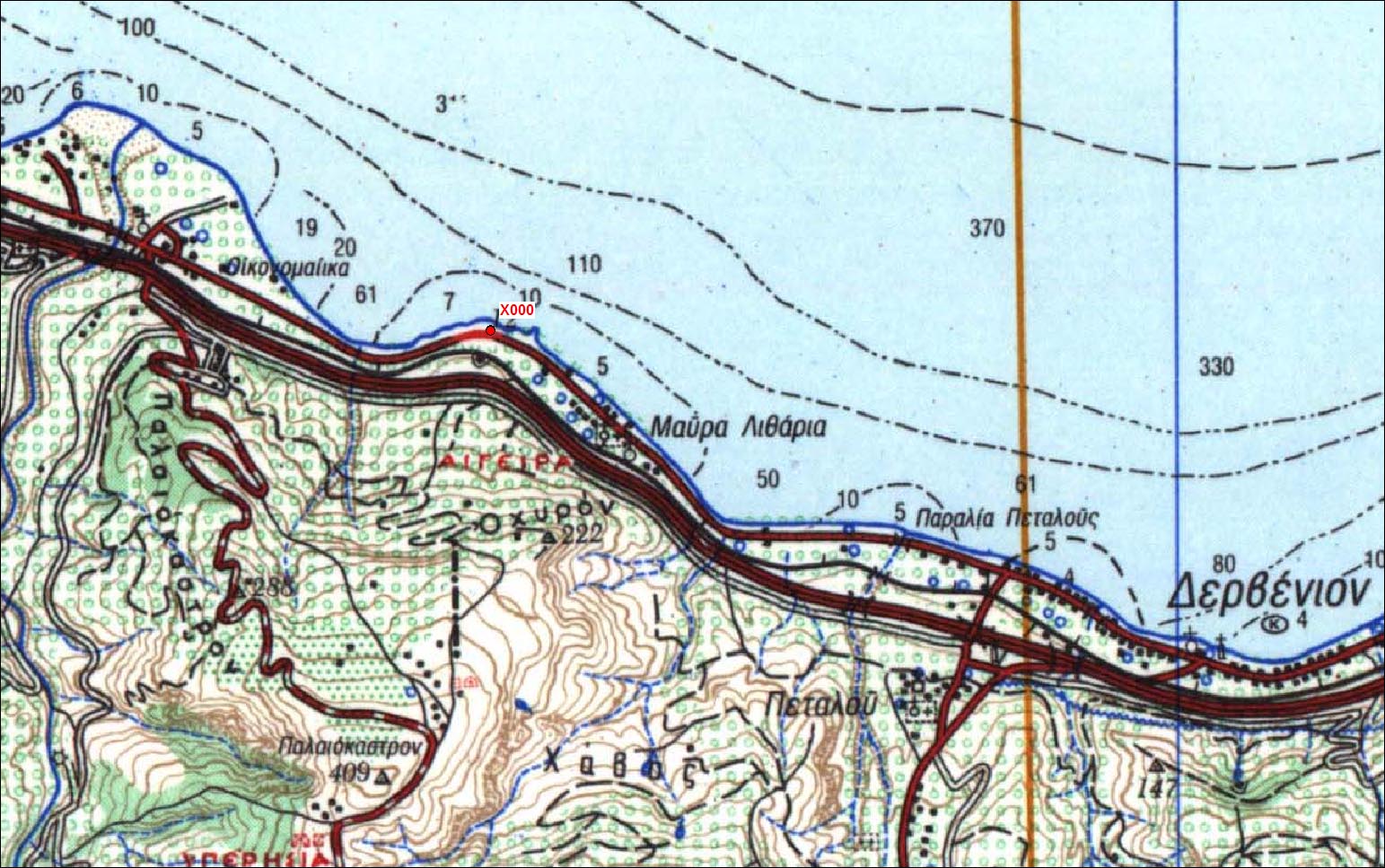
Carte: Derveni 1/50.000
| Point | Azimut et distance | Type de repère | Observations |
|---|
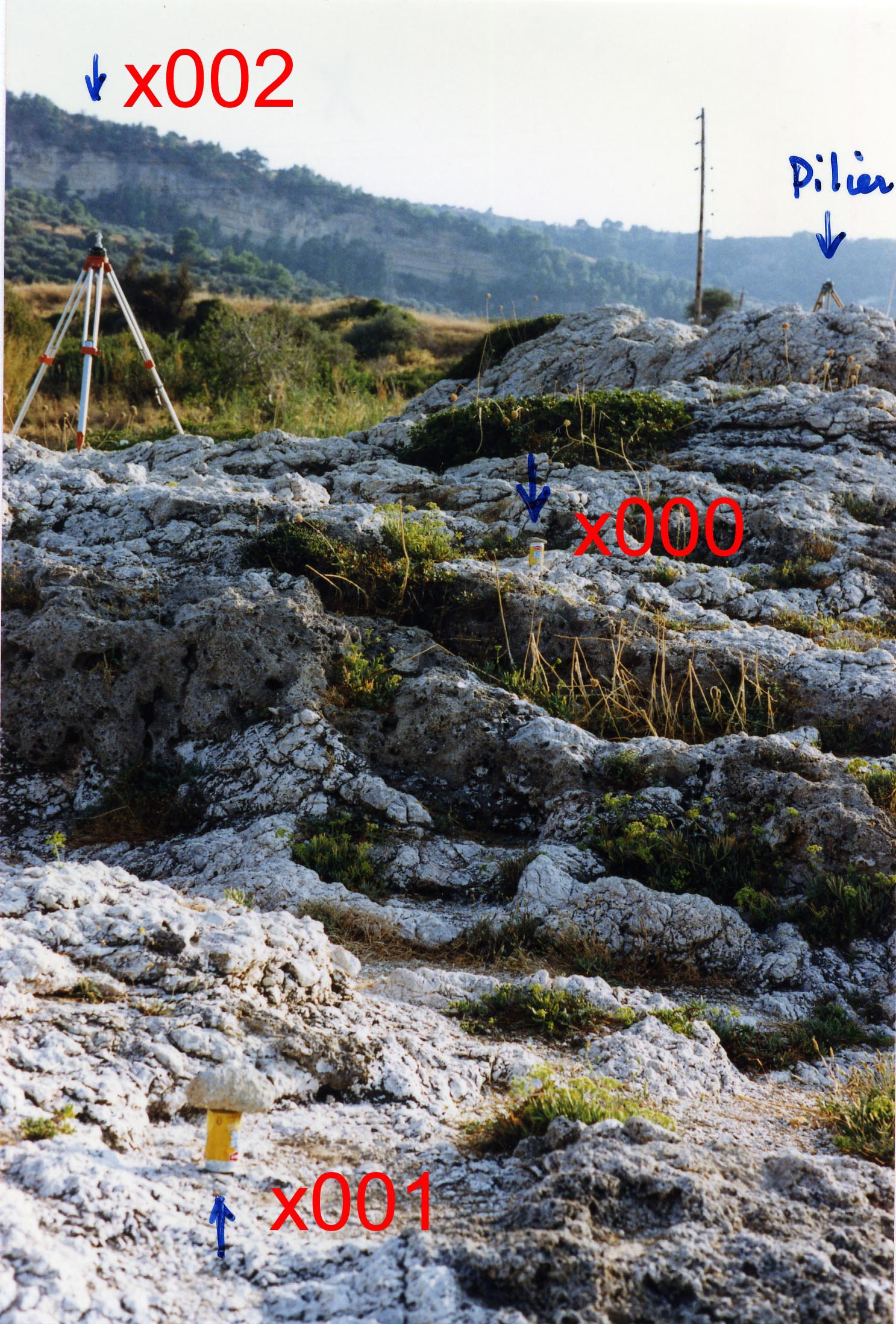
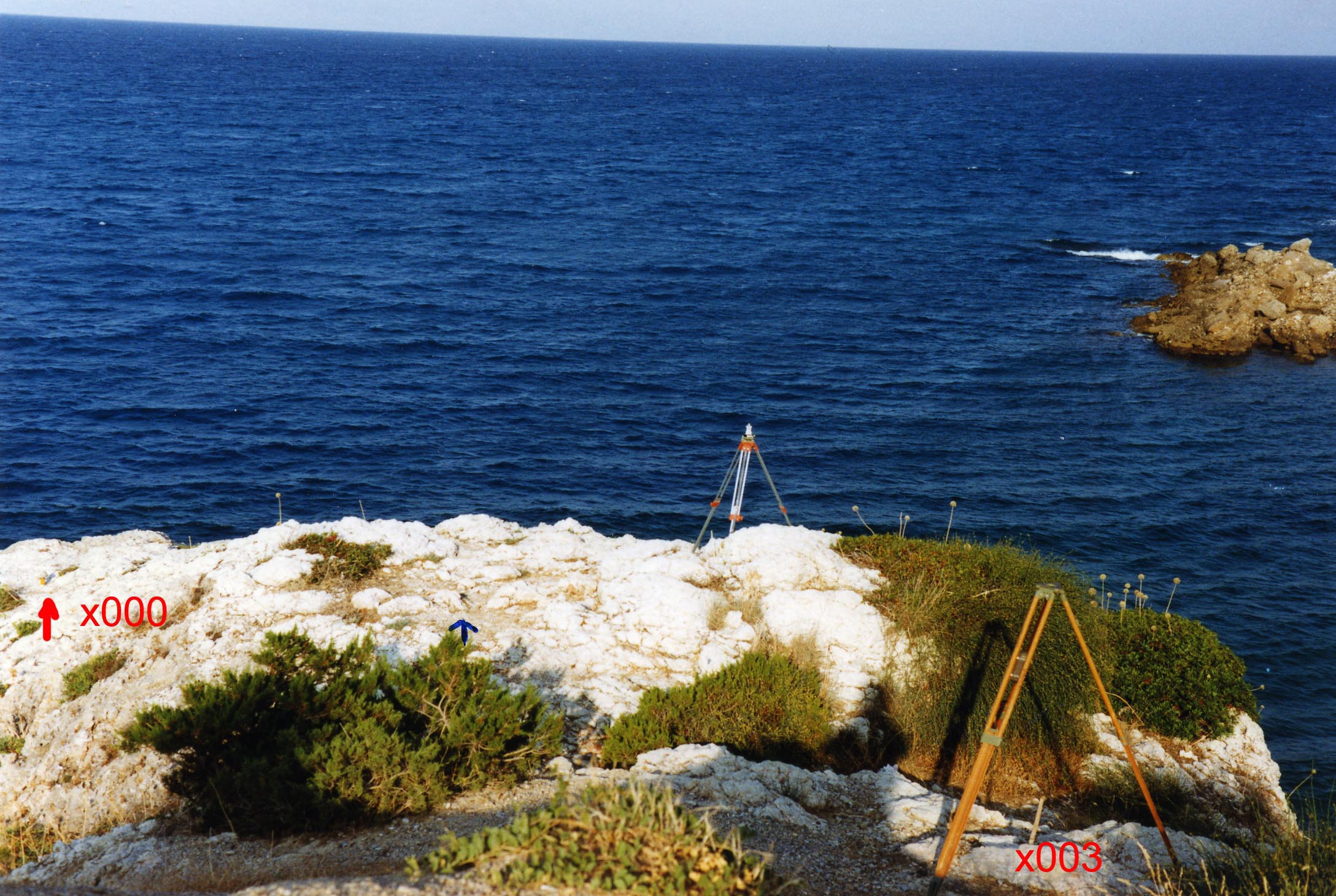
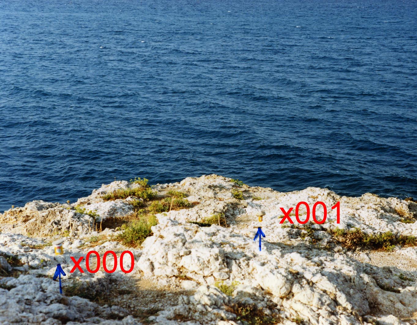
| 0284-0 | N | m | | |
| 0284-1 | N 41 | 5.58 m | RBPM dans roche | Auxiliaire 1 |
| 0284-2 | N 183 | 6.24 m | RBPM dans roche | Auxiliaire 2 |
| 0284-3 | N 227 | 14.83 m | Petit repère | Auxiliaire 3 |
| 0284-4 | N | m | Pilier (cote 12) | |
| 0381-0 | N | m | Pilier | X715 - Porovitsa |
Accès:
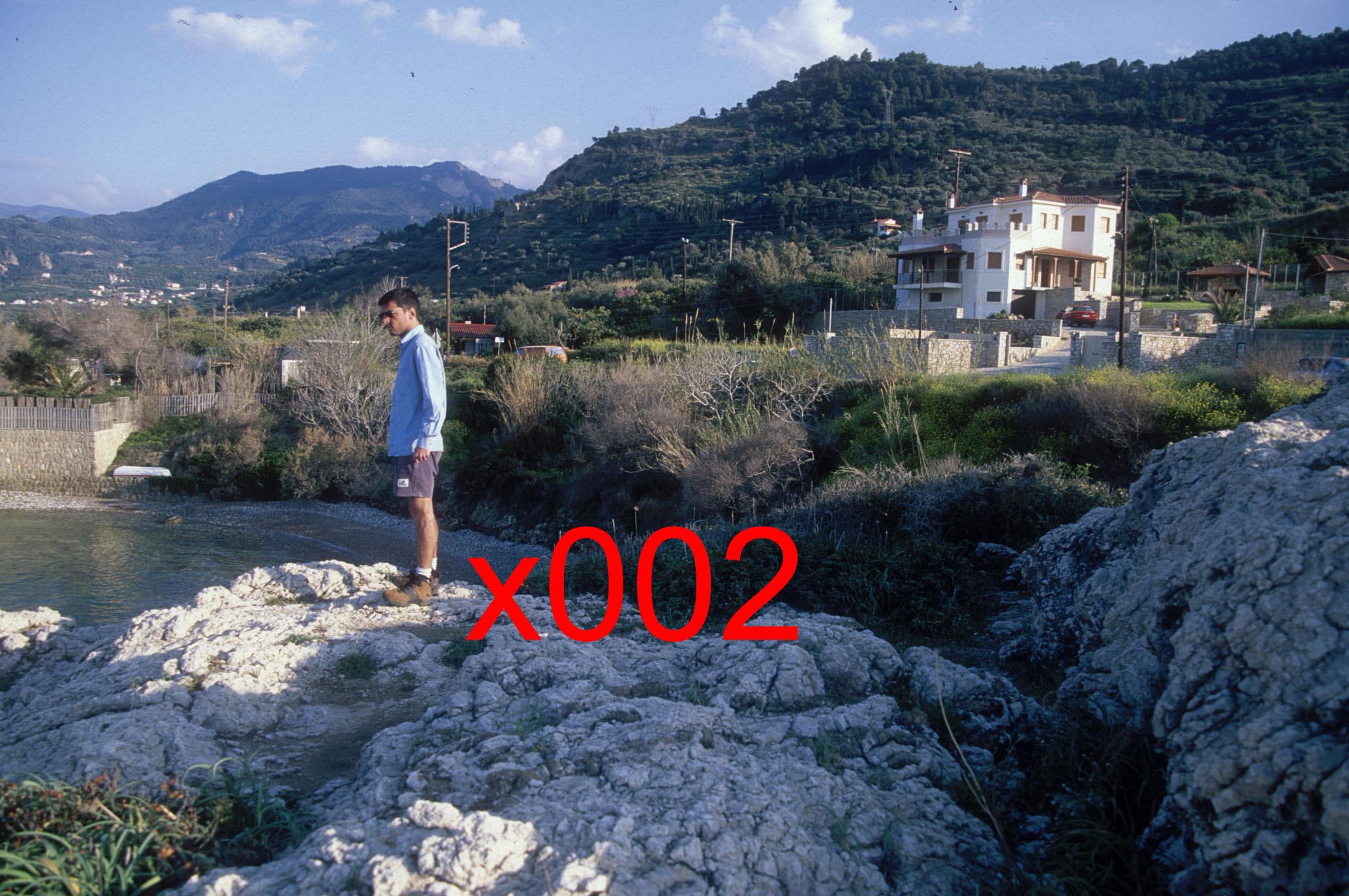
Le long de la route nationale, environ 4km à l'Ouest de Derveni. Le pilier est bien visible en venant d'Aigion (gauche de la route). Le point GPS est situé en contrebas du pilier sur le promontoire rocheux.
Carte Derveni
Toutes les cartes
Coordonnées UTM
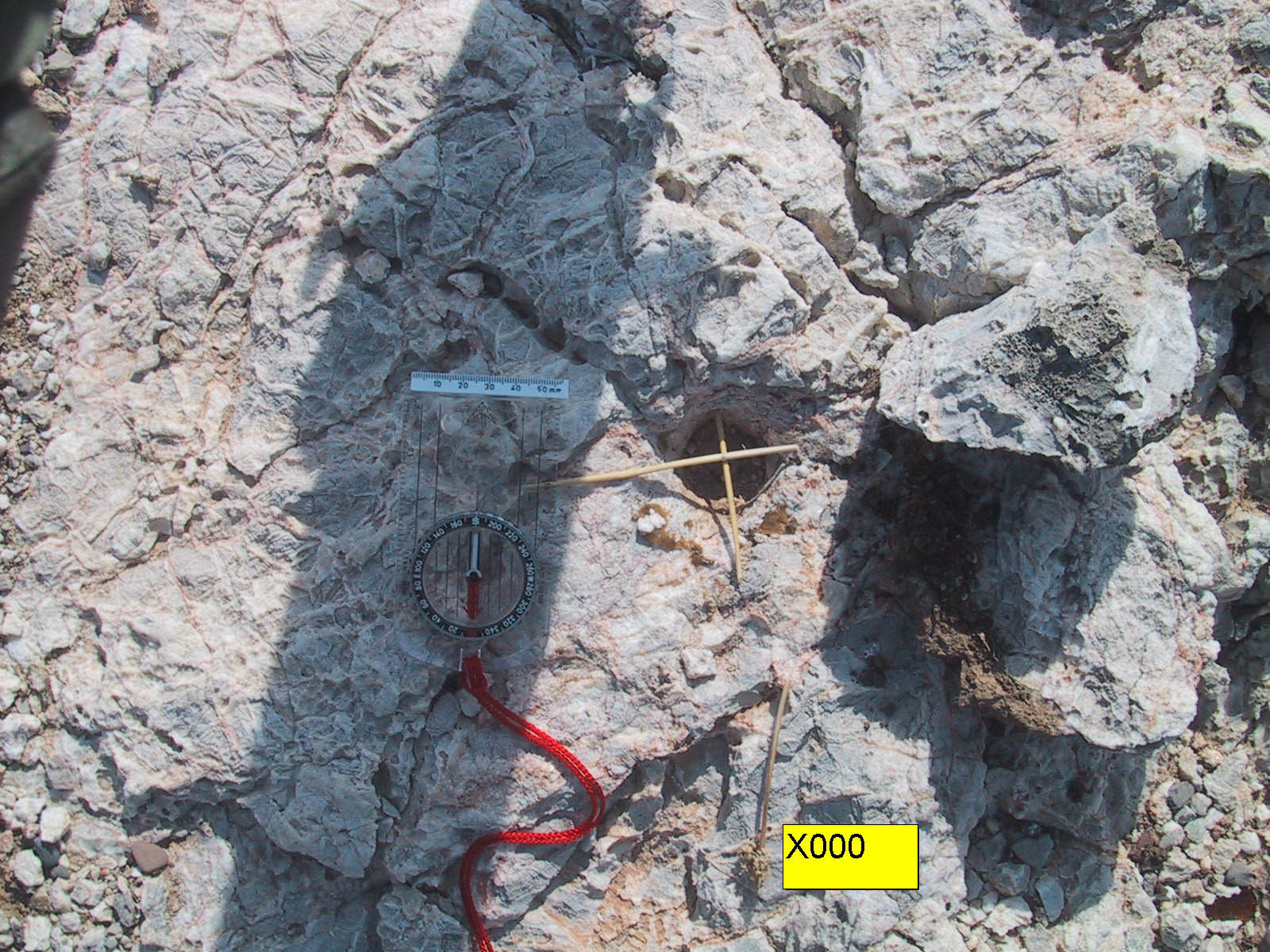
X000 620946.2011 4222562.194 38.8913
X001 620949.5327 4222566.429 37.603
X002 620946.0025 4222556.01 39.697
X003 620935.5936 4222552.132 41.3669
 |
|
 |
|
 |
| Septembre 1991 |
 |
| Septembre 1991 |
 |
| Septembre 1991 |
 |
| 8 Avril 2000 |
 |
| X000 en 2005 |
Historique:
1994/09/22 16:21-21:31 1.311o U3-366 Briole/Cattin
1994/09/24 18:26-21:30 1.543o U8-340 Kamberos
1994/09/28 16:07-22:12 0.988o U8-340 Kamberos


1997/10/01 09:41-23:59 1.039 OBS5 Psaraftis/Gaulon X002 stationne
1997/10/02 00:00-10:15 1.039 OBS5 XOO2
1997/10/06 17:19-23:59 1.020 OBS3 XOO2
1997/10/07 00:00-05:29 1.020 OBS3 X002
1997/10/10 10:19-13:14 1.083 OBS3 X002
Fichiers RINEX disponibles:
| 2001 |
x000263m.01d.Z(1)
x000264n.01d.Z(1)
|
| 2005 |
x000277l.05d.Z(1)
|
| 2006 |
x000269o.06d.Z(1)
x000270i.06d.Z(1)
|
| 1995 |
x000279a.95d.Z(1)
|
| 1997 |
x000283k.97d.Z(1)
|