FICHE DESCRIPTIVE - RESEAU GPS Corinthe | ||
|
|
|
ordre 1
|
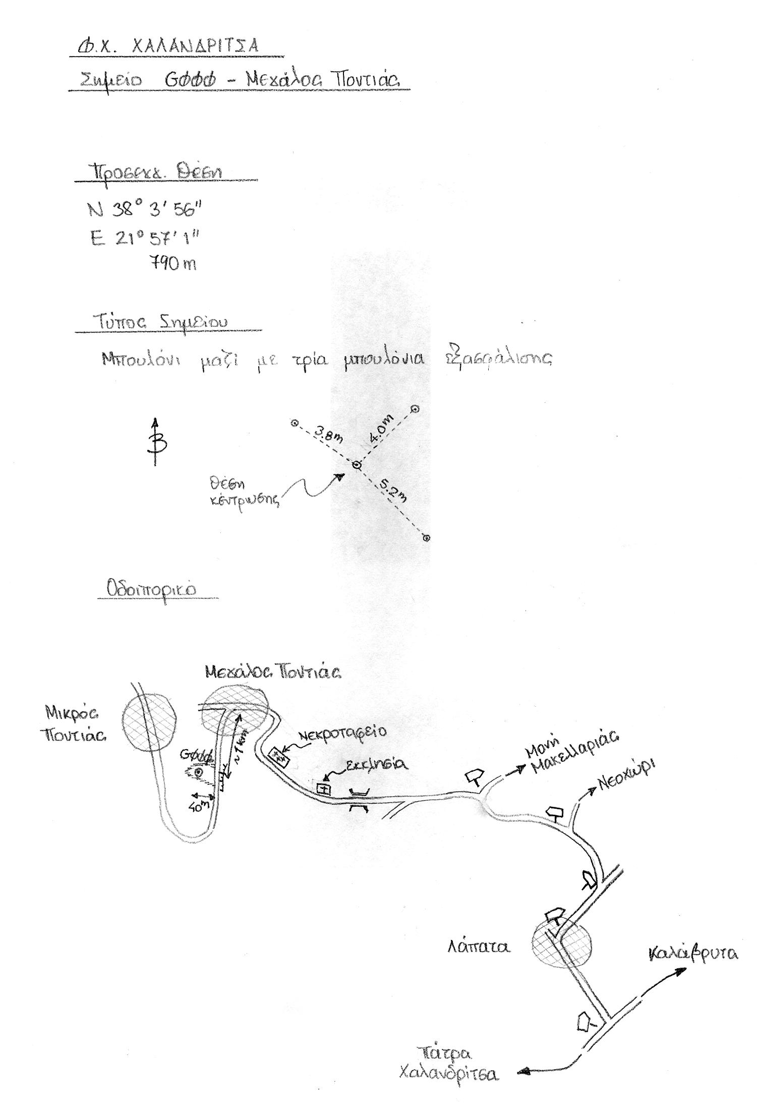
| G000 | Megalos Pontias | 0254-0 |
| WGS84 |
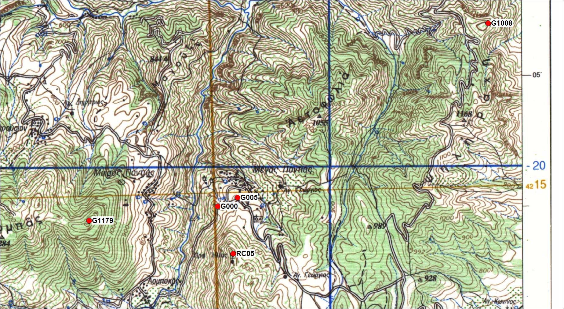
| 38° 03' 56'' N | 21° 57' 01'' E | 757 m |
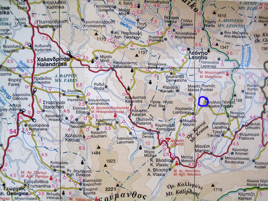
Carte: Halandritsa 1/50.000
| Point | Azimut et distance | Type de repère | Observations |
|---|
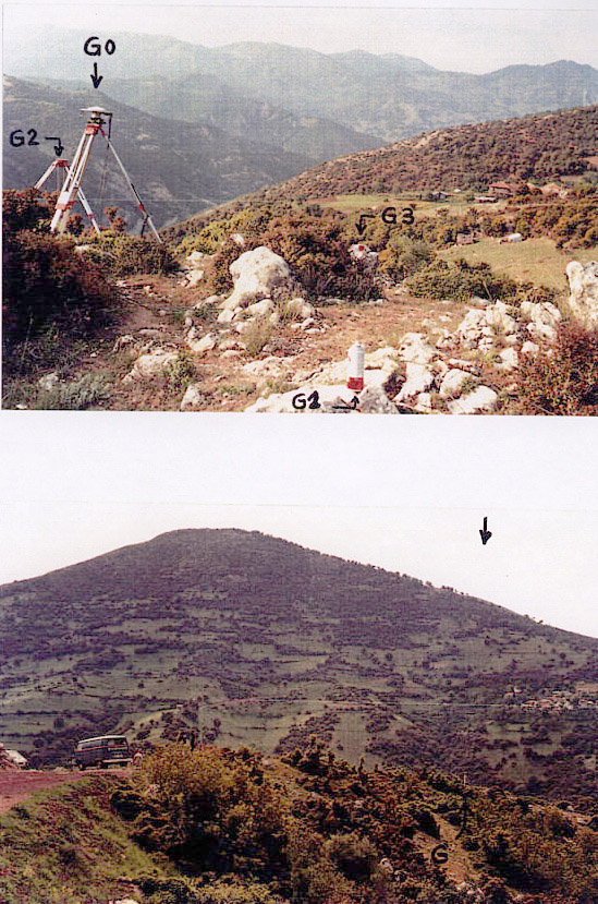
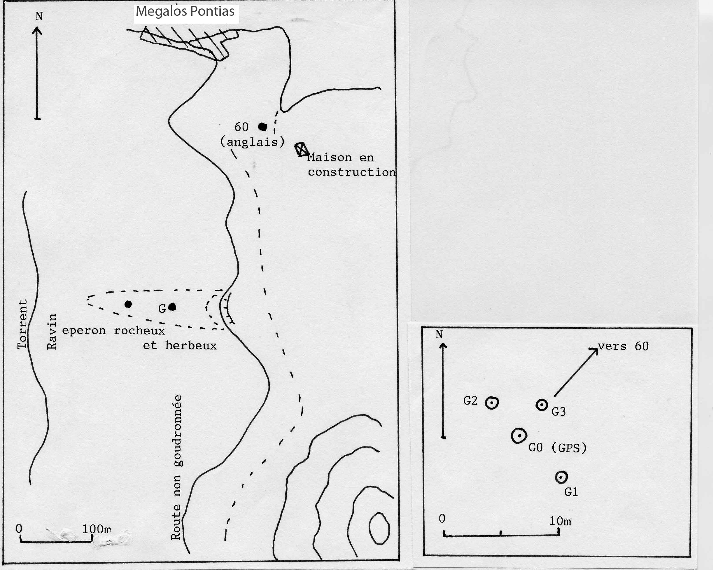
| 0254-0 | N | m | RBGM | |
| 0254-1 | N 155 | 5.2 m | Clou dans roche | Auxiliaire 1 |
| 0254-2 | N 340 | 3.8 m | Clou dans roche | Auxiliaire 2 |
| 0254-3 | N 44 | 4 m | Clou dans roche | Auxiliaire 3 |
| 0254-7 | N | m | Pilier (cote 907) | |
| 0309-0 | N | m | Pilier (cote 1008) | |
| CG60 | N 55 | 312 m | RBPM dans roche | |
Accès:
Attention aux chèvres et aux tortues.
Coordonnées UTM
G000 583351.925 4213524.773 786.859
G001 583353.998	4213519.941 787.165
G002 583350.789	4213528.339 786.265
G003 583354.574	4213526.452 786.791
G005  583634.2982 4213651.522 825.76
G1008 587167.977 4216145.729 1039.116
G1044 576686.662 4211566.402 1073.513
G1115 576397.119 4212623.101 1145.054
G907  582889.9733 4206851.97
Fichiers RINEX disponibles:
| 2001 |
g000266a.01d.Z(1)
g000261o.01d.Z(1)
g000262a.01d.Z(1)
g000265n.01d.Z(1)
|
| 2006 |
g000278a.06d.Z(1)
g000277a.06d.Z(1)
g000276l.06d.Z(1)
|
| 2011 |
g000272k.11d.Z(1)
|
| 1999 |
g000273a.99d.Z(1)
g000272k.99d.Z(1)
|